


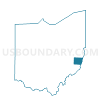
Voting District WAYNE TOWNSHIP, Belmont County, Ohio
About
Outline

Summary
| Unique Area Identifier | 642913 |
| Name | Voting District WAYNE TOWNSHIP |
| County | Belmont County |
| State | Ohio |
| Area (square miles) | 35.64 |
| Land Area (square miles) | 35.27 |
| Water Area (square miles) | 0.37 |
| % of Land Area | 98.95 |
| % of Water Area | 1.05 |
| Latitude of the Internal Point | 39.90380630 |
| Longtitude of the Internal Point | -81.07226250 |
Maps


Graphs
Select a template below for downloading or customizing gragh for Voting District WAYNE TOWNSHIP, Belmont County, Ohio


Neighbors
Neighoring Voting District (by Name) Neighboring Voting District on the Map
- Voting District CENTERVILLE WARNOCK, Belmont County, OH
- Voting District GOSHEN EAST & WEST, Belmont County, OH
- PRECINCT MALAGA EAST, Monroe County, OH
- PRECINCT SUNSBURY, Monroe County, OH
- Voting District SOMERTON, Belmont County, OH
- Voting District WARREN NORTH & SOUTH, Belmont County, OH
- Voting District WASHINGTON TOWNSHIP, Belmont County, OH
Top 10 Neighboring County Subdivision (by Population) Neighboring County Subdivision on the Map
- Warren township, Belmont County, OH (5,974)
- Goshen township, Belmont County, OH (3,147)
- Smith township, Belmont County, OH (1,543)
- Sunsbury township, Monroe County, OH (1,325)
- Somerset township, Belmont County, OH (1,245)
- Malaga township, Monroe County, OH (1,062)
- Wayne township, Belmont County, OH (709)
- Washington township, Belmont County, OH (517)
Top 10 Neighboring Place (by Population) Neighboring Place on the Map
Top 10 Neighboring Unified School District (by Population) Neighboring Unified School District on the Map
- Switzerland of Ohio Local School District, OH (17,913)
- Union Local School District, OH (9,175)
- Barnesville Exempted Village School District, OH (8,065)
Top 10 Neighboring State Legislative District Lower Chamber (by Population) Neighboring State Legislative District Lower Chamber on the Map
- State House District 96, OH (124,049)
- State House District 93, OH (116,725)
- State House District 95, OH (106,820)
Top 10 Neighboring State Legislative District Upper Chamber (by Population) Neighboring State Legislative District Upper Chamber on the Map
Top 10 Neighboring 111th Congressional District (by Population) Neighboring 111th Congressional District on the Map
Top 10 Neighboring Census Tract (by Population) Neighboring Census Tract on the Map
- Census Tract 109, Belmont County, OH (6,798)
- Census Tract 110, Belmont County, OH (5,009)
- Census Tract 9667, Monroe County, OH (3,773)
- Census Tract 112, Belmont County, OH (3,491)
Top 10 Neighboring 5-Digit ZIP Code Tabulation Area (by Population) Neighboring 5-Digit ZIP Code Tabulation Area on the Map
- 43713, OH (7,487)
- 43718, OH (3,209)
- 43719, OH (2,601)
- 43716, OH (1,973)
- 43747, OH (1,083)
- 43902, OH (202)